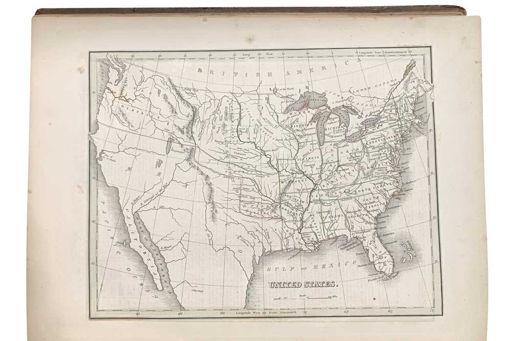
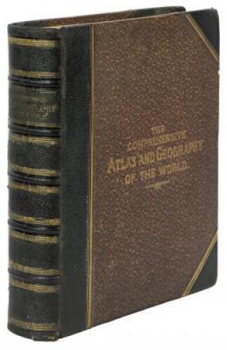
Title: A Comprehensive Atlas Geographical, Historical & Commercial Author: Bradford, T[homas] G[amaliel] Place: Boston / New York / Philadelphia Publisher: William D. Ticknor / Wiley & Long / T.T. Ash Date: [1835] Description: With 63 engraved maps with hand-colored outlines; 3 engraved plates with hand-colored borders (one with 15 U.S. city maps, one with 6 maps and one with 4 maps of major cities from around world); 10 engraved plates (3 with some hand-coloring and 2 with several vignettes); hand-colored frontispiece with tissue-guard; and a pictorially engraved title page. (4to) 12½x10, rebound in modern quarter morocco and marbled boards (in the style of the period), new endpapers. With several important early maps, including 28 full-page maps of the Americas, most pertaining to the United States. Map of the United States shows the Oregon Territory, but the Southwest portion including Texas shown as still belonging to Mexico (Texas and “R. Colorado of the West” named), the San Francisco Bay shown as “Bay of Sir F[rancis] Drake” and other interesting strange identifications. Also, the eastern United States exhibiting its railroads and canals; Michigan (with the Upper Portion still as Michilimackinac land); plus several other separate state maps and maps from around the world, including Europe and it’s various countries, Africa, Asia, Turkey and the Middle East, India, Oceanica, the Pacific and Atlantic Oceans, etc. Phillips Atlases 770. Lot Amendments Condition: Contents with mild offsetting and light foxing, occasional small stains, other minor wear; else very good or better - finely rebound. Item number: 159838
Title: A Comprehensive Atlas Geographical, Historical & Commercial Author: Bradford, T[homas] G[amaliel] Place: Boston / New York / Philadelphia Publisher: William D. Ticknor / Wiley & Long / T.T. Ash Date: [1835] Description: With 63 engraved maps with hand-colored outlines; 3 engraved plates with hand-colored borders (one with 15 U.S. city maps, one with 6 maps and one with 4 maps of major cities from around world); 10 engraved plates (3 with some hand-coloring and 2 with several vignettes); hand-colored frontispiece with tissue-guard; and a pictorially engraved title page. (4to) 12½x10, rebound in modern quarter morocco and marbled boards (in the style of the period), new endpapers. With several important early maps, including 28 full-page maps of the Americas, most pertaining to the United States. Map of the United States shows the Oregon Territory, but the Southwest portion including Texas shown as still belonging to Mexico (Texas and “R. Colorado of the West” named), the San Francisco Bay shown as “Bay of Sir F[rancis] Drake” and other interesting strange identifications. Also, the eastern United States exhibiting its railroads and canals; Michigan (with the Upper Portion still as Michilimackinac land); plus several other separate state maps and maps from around the world, including Europe and it’s various countries, Africa, Asia, Turkey and the Middle East, India, Oceanica, the Pacific and Atlantic Oceans, etc. Phillips Atlases 770. Lot Amendments Condition: Contents with mild offsetting and light foxing, occasional small stains, other minor wear; else very good or better - finely rebound. Item number: 159838


Testen Sie LotSearch und seine Premium-Features 7 Tage - ohne Kosten!
Lassen Sie sich automatisch über neue Objekte in kommenden Auktionen benachrichtigen.
Suchauftrag anlegen