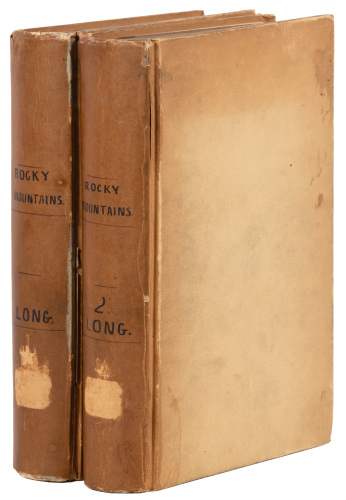
Account of an Expedition from Pittsburgh to the Rocky Mountains Edwin James, 1823 JAMES, Edwin (1797-1861). Account of an Expedition from Pittsburgh to the Rocky Mountains, performed in the Years 1819, 1820. London: Longman, Hurst, Rees, Orme and Brown, 1823. First English edition of the account of the Stephen H. Long Expedition. The Long Expedition of 1820 was the third major American exploration into the trans-Mississippi West, following Lewis and Clark and Pike. Long and his men traversed the Great Plains from the Missouri River to the Rocky Mountains across Kansas and Colorado. It was the first expedition accompanied by an artist, the landscape painter Samuel Seymour and the illustrations form an important early visual record. The maps are the first to detail the mapping of the Central Plains. "A valuable contribution to geographical and ethnographical literature" (Sabin). Abbey Travel 650; Howes J-41; Sabin 35683; Wagner-Camp 25:2. Three volumes, octavo (222 x 138mm). Three frontispieces, two of which are colored; five plates, one of which is colored; and two folding maps (stub tears to maps, vol. 3 lacking half-title). Original boards with manuscript titling and shelf labels (neatly recased, light wear to tips); modern full morocco clamshell box.
Account of an Expedition from Pittsburgh to the Rocky Mountains Edwin James, 1823 JAMES, Edwin (1797-1861). Account of an Expedition from Pittsburgh to the Rocky Mountains, performed in the Years 1819, 1820. London: Longman, Hurst, Rees, Orme and Brown, 1823. First English edition of the account of the Stephen H. Long Expedition. The Long Expedition of 1820 was the third major American exploration into the trans-Mississippi West, following Lewis and Clark and Pike. Long and his men traversed the Great Plains from the Missouri River to the Rocky Mountains across Kansas and Colorado. It was the first expedition accompanied by an artist, the landscape painter Samuel Seymour and the illustrations form an important early visual record. The maps are the first to detail the mapping of the Central Plains. "A valuable contribution to geographical and ethnographical literature" (Sabin). Abbey Travel 650; Howes J-41; Sabin 35683; Wagner-Camp 25:2. Three volumes, octavo (222 x 138mm). Three frontispieces, two of which are colored; five plates, one of which is colored; and two folding maps (stub tears to maps, vol. 3 lacking half-title). Original boards with manuscript titling and shelf labels (neatly recased, light wear to tips); modern full morocco clamshell box.
.jpg)


Testen Sie LotSearch und seine Premium-Features 7 Tage - ohne Kosten!
Lassen Sie sich automatisch über neue Objekte in kommenden Auktionen benachrichtigen.
Suchauftrag anlegen