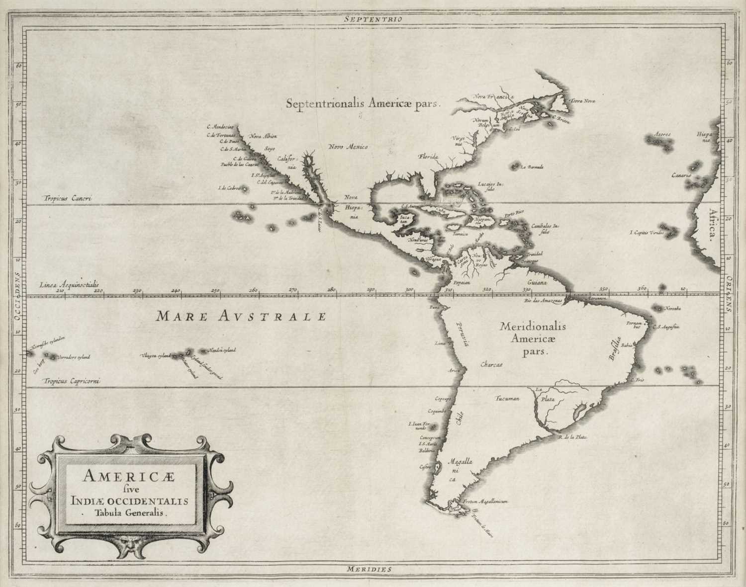
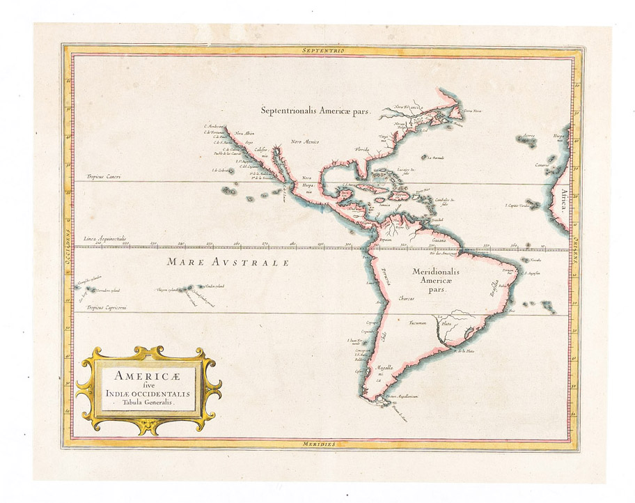
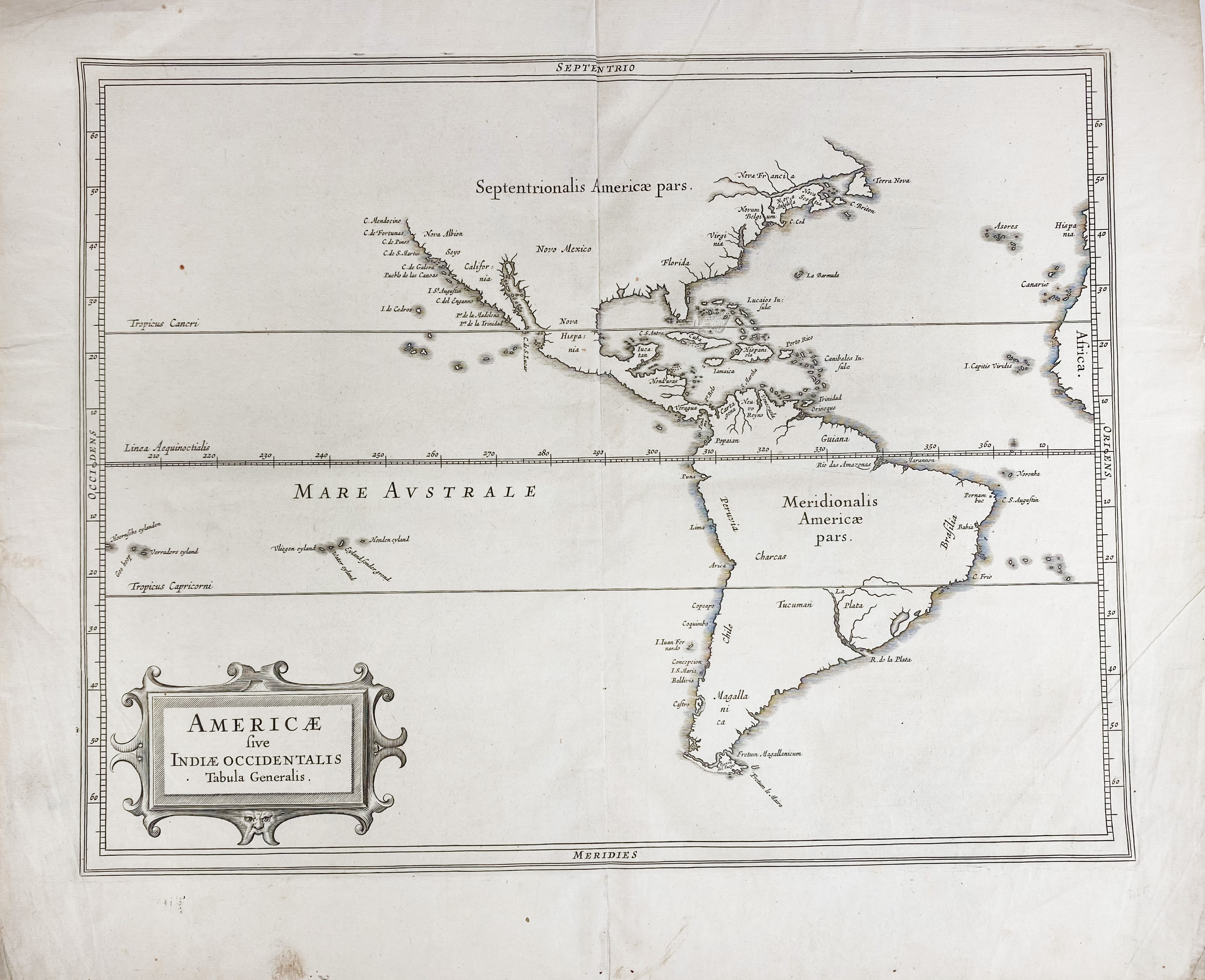
Title: Americae sive Indiae Occidentalis Tabula Generalis Author: De Laet, Joannes Place: Leiden Publisher: Date: 1630 Description: Copper-engraved map. modern hand-coloring in outline. 27.8x35.4 cm. (11x14"). A simple map, lacking adornment and pretention, but quite significant and notable for its accuracy for the time. This map was issued in the second edition of Beschrijyvinghe van West-Indien; the 1625 first edition had ten maps, but not this one. Burden notes that "Considerable effort went into making the text and maps of this work the most accurate available at the time. It is arguably the finest description of the Americas published in the seventeenth century. The exhaustive research involved de Laet reading all the published and manuscript material that he could find. For the cartographic work he had much to call on, being a director of the recently formed Dutch West India Company in charge of all Dutch interests in America and Africa. He therefore had access to the latest geographic knowledge. He also drew upon the fine talents of Hessel Gerritaz, the official cartographer to the Dutch East India Company since 1617. This was a post he attained before Willem Blaeu, under whom he was apprenticed, and who was his senior by ten years. The maps were some of the first to depart from the heavier style of the Mercator and Ortelius period. This more open style of engraving was one that both Blaeu and Janssonius would develop in their atlases..." In describing the present map, Burden states that "Its most interesting feature is that although we know de Laet had seen maps of California as an island, he relies on the more trustworthy accounts, such as Herrerra, in depicting a peninsular form. This map has the best west coast delineation to date. He also does not get drawn into the debate about the North West Passage, preferring to cut his map short of these latitudes..." There were editions in Latin (1633) and French (1640), but with no apparent differences in the maps, although the present example seems to be on different paper than the preceding. Burden 229; Wagner 309. Lot Amendments Condition: Several marginal repairs, repair at lower central crease, right margin extended, likely washed, quite clean and attractive. Item number: 163704
Title: Americae sive Indiae Occidentalis Tabula Generalis Author: De Laet, Joannes Place: Leiden Publisher: Date: 1630 Description: Copper-engraved map. modern hand-coloring in outline. 27.8x35.4 cm. (11x14"). A simple map, lacking adornment and pretention, but quite significant and notable for its accuracy for the time. This map was issued in the second edition of Beschrijyvinghe van West-Indien; the 1625 first edition had ten maps, but not this one. Burden notes that "Considerable effort went into making the text and maps of this work the most accurate available at the time. It is arguably the finest description of the Americas published in the seventeenth century. The exhaustive research involved de Laet reading all the published and manuscript material that he could find. For the cartographic work he had much to call on, being a director of the recently formed Dutch West India Company in charge of all Dutch interests in America and Africa. He therefore had access to the latest geographic knowledge. He also drew upon the fine talents of Hessel Gerritaz, the official cartographer to the Dutch East India Company since 1617. This was a post he attained before Willem Blaeu, under whom he was apprenticed, and who was his senior by ten years. The maps were some of the first to depart from the heavier style of the Mercator and Ortelius period. This more open style of engraving was one that both Blaeu and Janssonius would develop in their atlases..." In describing the present map, Burden states that "Its most interesting feature is that although we know de Laet had seen maps of California as an island, he relies on the more trustworthy accounts, such as Herrerra, in depicting a peninsular form. This map has the best west coast delineation to date. He also does not get drawn into the debate about the North West Passage, preferring to cut his map short of these latitudes..." There were editions in Latin (1633) and French (1640), but with no apparent differences in the maps, although the present example seems to be on different paper than the preceding. Burden 229; Wagner 309. Lot Amendments Condition: Several marginal repairs, repair at lower central crease, right margin extended, likely washed, quite clean and attractive. Item number: 163704




Testen Sie LotSearch und seine Premium-Features 7 Tage - ohne Kosten!
Lassen Sie sich automatisch über neue Objekte in kommenden Auktionen benachrichtigen.
Suchauftrag anlegen