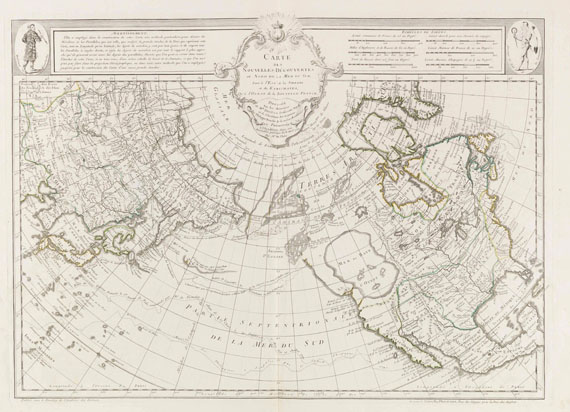
DELISLE, Joseph-Nicolas and others, compilers]. Atlas Russicus... Atlas Russien: contenant une carte générale et dixneuf cartes particuliéres de tout l'empire de Russie et des Pays Limitrophes . St.Petersburg: [Imperial Academy of Sciences], 1745.
DELISLE, Joseph-Nicolas and others, compilers]. Atlas Russicus... Atlas Russien: contenant une carte générale et dixneuf cartes particuliéres de tout l'empire de Russie et des Pays Limitrophes . St.Petersburg: [Imperial Academy of Sciences], 1745. 2 o (532 x 328 mm). Letterpress title and text in Latin and French. Engraved key to the symbols used on verso of D2. Large folding map of Russia with outlines hand-colored, 19 engraved double-page regional maps. (B1 with crease along gutter margin.) Contemporary calf-backed marbled boards (a bit rubbed, joints worn). A FINE COPY OF THE FIRST ATLAS DEVOTED SOLELY TO RUSSIA. In 1729, four years after accepting Peter the Great's invitation to come to St. Petersburg, Delisle suggested an atlas of the entire Russian empire (to a single scale) on 16 sheets. In 1735 the Academy gave its backing and accurate measurements from a number of expeditions (many with members trained by Delisle) were all coordinated to produce the present work. The text was issued in various languages: Russian, German, Latin and French, and in combination, as here. It is effectively in two parts: the first on European Russia, the second on Siberia (using a much smaller scale). Bagrow-Castner II, pp.177-253 (collation pp.243-244); Phillips Atlases 4060.

.jpg)


.jpg)
.jpg)


Testen Sie LotSearch und seine Premium-Features 7 Tage - ohne Kosten!
Lassen Sie sich automatisch über neue Objekte in kommenden Auktionen benachrichtigen.
Suchauftrag anlegen