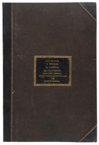
EUGÈNE DUFLOT DE MOFRAS (1810-1884) Exploration du Territoire de l'Orégon, des Californies, et de la Mer Vermeille, exécutée pendant les années 1840, 1841, et 1842. Paris: Arthus Bertrand 1844. 2 text volumes, 8° (228 x 147mm) and atlas volume, 2° (542 x 362mm). Text: 8 engravings; Atlas: folding voyage map hand-coloured in outline, 25 engravings on 17 sheets, one double-page, comprising 21 charts and 4 plates. (Text: occasional light browning and spotting; Atlas: folding map and double page map with short marginal tear repaired, folding map lightly browned, title and one one plate with marginal repair, a few plates soiled) Black quarter morocco [text] and half morocco [atlas], spines lettered in gilt (extremities rubbed, front joint of Vol. II starting, sides of atlas scuffed, and without cornerpieces). FIRST EDITION, 'A VERY RARE WORK' (Hill), and the best book on California for this period. 'This is one of the most important works on the northwestern coast, including Alaska' (Lada-Mocarski). Duflot de Mofras had been sent to Mexico in 1839 ostensibly to act as French Ambassador. His real motive was to provide the French government with information about the Pacific Coast of North America to help decide whether or not to become embroiled in the conflict over Oregon between the United States and Britain. His description includes the western coast of America from Tehuantepec to the Bering Strait, and considers the Spanish voyages of discovery, Vancouver Island, and the Fraser River. Cowan, p. 186; Graff 1169; Hill 496; Howes D-542; Lada-Mocarski 120; Sabin 21144; Zamorano Eighty 30. (3)
EUGÈNE DUFLOT DE MOFRAS (1810-1884) Exploration du Territoire de l'Orégon, des Californies, et de la Mer Vermeille, exécutée pendant les années 1840, 1841, et 1842. Paris: Arthus Bertrand 1844. 2 text volumes, 8° (228 x 147mm) and atlas volume, 2° (542 x 362mm). Text: 8 engravings; Atlas: folding voyage map hand-coloured in outline, 25 engravings on 17 sheets, one double-page, comprising 21 charts and 4 plates. (Text: occasional light browning and spotting; Atlas: folding map and double page map with short marginal tear repaired, folding map lightly browned, title and one one plate with marginal repair, a few plates soiled) Black quarter morocco [text] and half morocco [atlas], spines lettered in gilt (extremities rubbed, front joint of Vol. II starting, sides of atlas scuffed, and without cornerpieces). FIRST EDITION, 'A VERY RARE WORK' (Hill), and the best book on California for this period. 'This is one of the most important works on the northwestern coast, including Alaska' (Lada-Mocarski). Duflot de Mofras had been sent to Mexico in 1839 ostensibly to act as French Ambassador. His real motive was to provide the French government with information about the Pacific Coast of North America to help decide whether or not to become embroiled in the conflict over Oregon between the United States and Britain. His description includes the western coast of America from Tehuantepec to the Bering Strait, and considers the Spanish voyages of discovery, Vancouver Island, and the Fraser River. Cowan, p. 186; Graff 1169; Hill 496; Howes D-542; Lada-Mocarski 120; Sabin 21144; Zamorano Eighty 30. (3)


.jpg)


.jpg)


Testen Sie LotSearch und seine Premium-Features 7 Tage - ohne Kosten!
Lassen Sie sich automatisch über neue Objekte in kommenden Auktionen benachrichtigen.
Suchauftrag anlegen