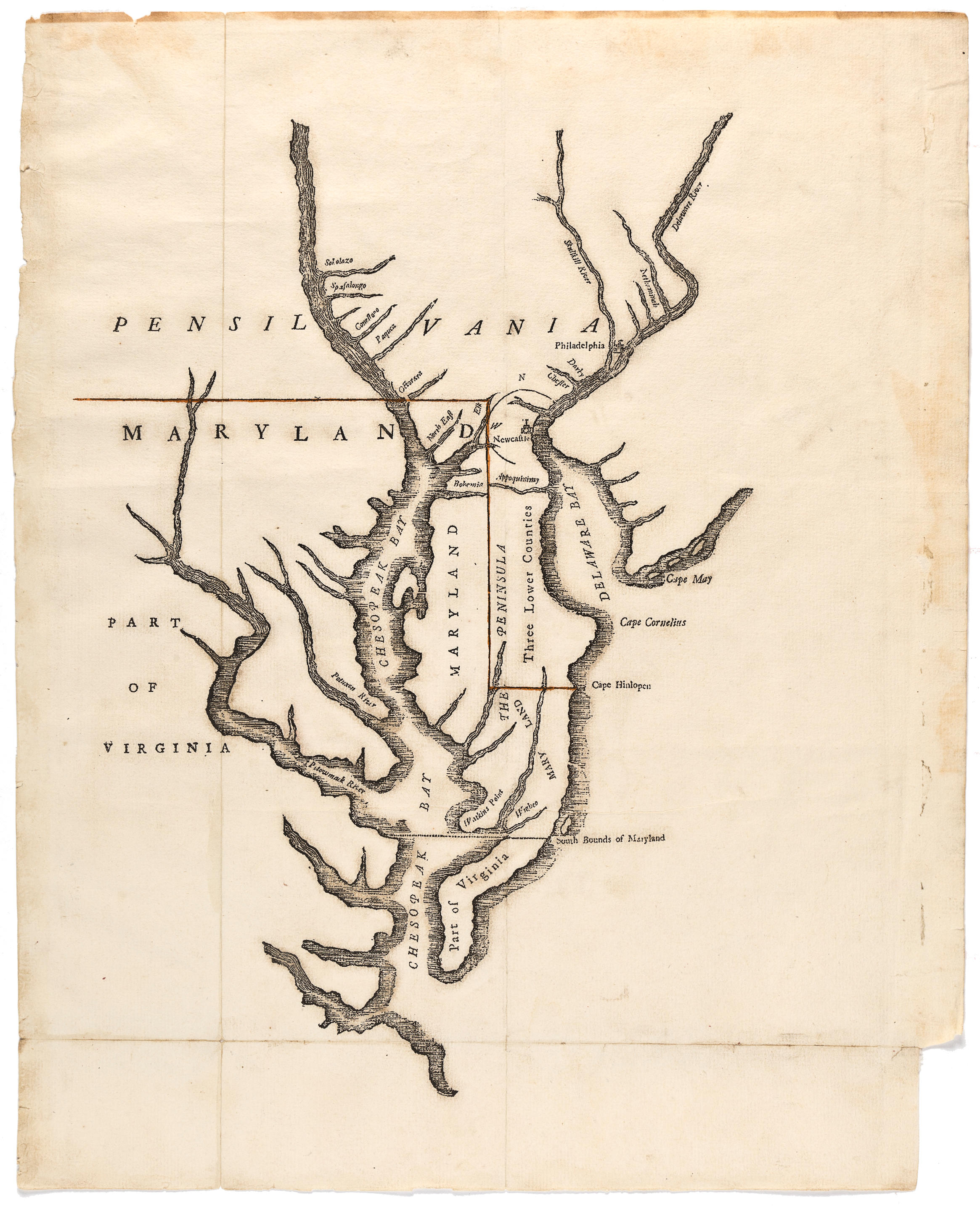
A Bill in the Chancery of New-Jersey, at the Suit of John Earl of Stair, and others, Proprietors of the Eastern-Division of New-Jersey; against Benjamin Bond, and some other Persons of Elizabeth-Town, distinguished by the Name of the Clinker Lot Right Men.... New York: Printed by James Parker and a few copies are to be sold by him. Philadelphia: [printed by] Benjamin Franklin 1747. 124, 11, [1 blank], [4], 13-15, 17-24, [1 blank], 39, [1 blank], [1] pp. Printed in two columns. With 3 folding maps by Lewis Evans and James Alexander, engraved by James Turner of Boston. Folio (351 x 221 mm). Period quarter sheep and marbled boards, likely publisher's binding. Custom half calf clamshell box. Browning, small ink spot to 2d map, marginal paper flaw to Bb2, corners well-worn, upper cover nearly detached. RARE FIRST EDITION, COMPLETE WITH THREE MAPS BY LEWIS EVANS INCLUDING THE FIRST AMERICAN GENERAL MAP OF THE MIDDLE COLONIES. "A monumental piece of printing" (Miller). This Bill relates to the long-standing dispute over land taxes in the area of Elizabeth, New Jersey between the Proprietors, who were deeded land from Carteret, and the resident settlers who had for the most part purchased their lots from the native Indians. The Proprietors' case was prepared by the Scottish lawyer, James Alexander [c.1690-1756], already famous for his representation of Peter Zenger in the first case to set a precedent for freedom of the press in America. "This exposition of the proprietors' case by James Alexander is of great subtlety and complexity and is one of the most remarkable documents of colonial times" (Streeter). The maps prepared by Lewis Evans are highly sought after in themselves as very early examples of indigenous American map-making. They comprise: Map I of the middle colonies from Boston Harbor to Cape Hatteras and inland to Albany, the cartouche provides a key between the English and the old Dutch names and a coloring guide; Map II of New Jersey, also showing the Hudson and New York City; Map III of the disputed property detailing individually numbered lots. Lewis Evans prepared the maps, they were corrected by James Alexander, and engraved and printed by James Parker who was suggested for the work by Benjamin Franklin The present copy is in beautiful, unrestored condition. According to Miller, this binding was probably done by John Hyndshaw and Robert McAlpine of New York City. Church 961; Evans 18640; Felcone 21; Miller 426; Streeter sale 918. Provenance: receipt laid in dated 1798 from Rushout to Capp. Acquisition: Laird Park sale, Sotheby's New York, Nov 29, 2000, lot 102, $24,900.
A Bill in the Chancery of New-Jersey, at the Suit of John Earl of Stair, and others, Proprietors of the Eastern-Division of New-Jersey; against Benjamin Bond, and some other Persons of Elizabeth-Town, distinguished by the Name of the Clinker Lot Right Men.... New York: Printed by James Parker and a few copies are to be sold by him. Philadelphia: [printed by] Benjamin Franklin 1747. 124, 11, [1 blank], [4], 13-15, 17-24, [1 blank], 39, [1 blank], [1] pp. Printed in two columns. With 3 folding maps by Lewis Evans and James Alexander, engraved by James Turner of Boston. Folio (351 x 221 mm). Period quarter sheep and marbled boards, likely publisher's binding. Custom half calf clamshell box. Browning, small ink spot to 2d map, marginal paper flaw to Bb2, corners well-worn, upper cover nearly detached. RARE FIRST EDITION, COMPLETE WITH THREE MAPS BY LEWIS EVANS INCLUDING THE FIRST AMERICAN GENERAL MAP OF THE MIDDLE COLONIES. "A monumental piece of printing" (Miller). This Bill relates to the long-standing dispute over land taxes in the area of Elizabeth, New Jersey between the Proprietors, who were deeded land from Carteret, and the resident settlers who had for the most part purchased their lots from the native Indians. The Proprietors' case was prepared by the Scottish lawyer, James Alexander [c.1690-1756], already famous for his representation of Peter Zenger in the first case to set a precedent for freedom of the press in America. "This exposition of the proprietors' case by James Alexander is of great subtlety and complexity and is one of the most remarkable documents of colonial times" (Streeter). The maps prepared by Lewis Evans are highly sought after in themselves as very early examples of indigenous American map-making. They comprise: Map I of the middle colonies from Boston Harbor to Cape Hatteras and inland to Albany, the cartouche provides a key between the English and the old Dutch names and a coloring guide; Map II of New Jersey, also showing the Hudson and New York City; Map III of the disputed property detailing individually numbered lots. Lewis Evans prepared the maps, they were corrected by James Alexander, and engraved and printed by James Parker who was suggested for the work by Benjamin Franklin The present copy is in beautiful, unrestored condition. According to Miller, this binding was probably done by John Hyndshaw and Robert McAlpine of New York City. Church 961; Evans 18640; Felcone 21; Miller 426; Streeter sale 918. Provenance: receipt laid in dated 1798 from Rushout to Capp. Acquisition: Laird Park sale, Sotheby's New York, Nov 29, 2000, lot 102, $24,900.


.jpg)


.jpg)


Testen Sie LotSearch und seine Premium-Features 7 Tage - ohne Kosten!
Lassen Sie sich automatisch über neue Objekte in kommenden Auktionen benachrichtigen.
Suchauftrag anlegen