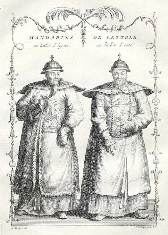
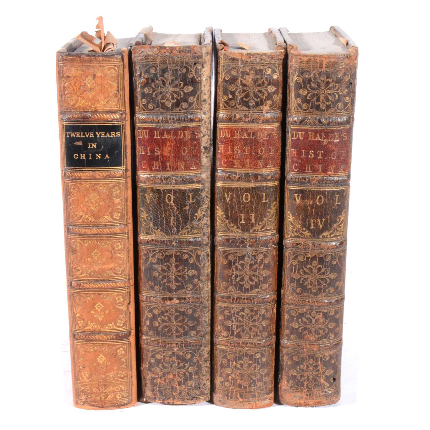
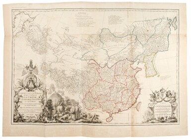
JEAN BAPTISTE DU HALDE (1674-1743) Description Géographique, Historique, Chronologique, Politique et Physique de l'Empire de la Chine . Paris: P.G. Le Mercier, 1735. 4 volumes, 2° (437 x 273mm). Titles in red and black. Engraved title vignettes by M. Baquoy after A. Humblot, 4 engraved head-pieces after Humblot, 64 engraved plates and maps, many folding or double-page, by Delahaye, Desbrulins, Fonbonne after Humblot, Lucas, Le Parmentier and others, engraved and woodcut initials, woodcut headpieces. (Volume 2 with marginal wormtrack, a very few very occasional scattered spots, occasional faint browning.) Contemporary mottled calf gilt, spine compartments with small bird tools, red and black morocco labels (some joints starting, corners rubbed, small chips at spine heads, small area of superficial loss on upper side of vol.3, a few labels with wear). Provenance : Charles Hamilton (armorial bookplate) -- Dukes of Abercorn. FIRST EDITION OF DU HALDE'S 'ENCYCLOPEDIC SURVEY OF CHINA' (Lust); 'ouvrage très important ... le premier qui ait fait connaître la Chine d'une manière un peu exacte' (NBG), and one of the earliest European sources on Chinese ceramics. Du Halde became a Jesuit in 1708 and was entrusted by his superiors with editing the published and manuscript accounts of Jesuit travellers in China. The present work records the accounts of twenty-seven of these (who are listed on volume I, pp. li-lii), and is notable for the 'Relation succinte du voyage du capitaine Beering dans la Sibérie' (volume IV, pp.452-458), which details Bering's 1728 voyage through the eponymous straits; the double-page 'Carte des pays travers ees par le Capne. Beering depuis la ville de Tobolsk jusqu'á Kamtschatka' bound between pp.452 and 453 is based on Bering's manuscript map, which was given to the King of Poland and in turn was passed to Du Halde to be reproduced here. This is 'the first printed map of part of present Alaska' (S.I. Schwarz and R.E. Ehrenberg, The Mapping of America (New York: 1980, p.151). Brunet II, 870; Cordier Bibliotheca sinica I, 45-48 (calling for only 4 rather than 5 plates in volume III); Lust, Western Books on China 12. (4)
JEAN BAPTISTE DU HALDE (1674-1743) Description Géographique, Historique, Chronologique, Politique et Physique de l'Empire de la Chine . Paris: P.G. Le Mercier, 1735. 4 volumes, 2° (437 x 273mm). Titles in red and black. Engraved title vignettes by M. Baquoy after A. Humblot, 4 engraved head-pieces after Humblot, 64 engraved plates and maps, many folding or double-page, by Delahaye, Desbrulins, Fonbonne after Humblot, Lucas, Le Parmentier and others, engraved and woodcut initials, woodcut headpieces. (Volume 2 with marginal wormtrack, a very few very occasional scattered spots, occasional faint browning.) Contemporary mottled calf gilt, spine compartments with small bird tools, red and black morocco labels (some joints starting, corners rubbed, small chips at spine heads, small area of superficial loss on upper side of vol.3, a few labels with wear). Provenance : Charles Hamilton (armorial bookplate) -- Dukes of Abercorn. FIRST EDITION OF DU HALDE'S 'ENCYCLOPEDIC SURVEY OF CHINA' (Lust); 'ouvrage très important ... le premier qui ait fait connaître la Chine d'une manière un peu exacte' (NBG), and one of the earliest European sources on Chinese ceramics. Du Halde became a Jesuit in 1708 and was entrusted by his superiors with editing the published and manuscript accounts of Jesuit travellers in China. The present work records the accounts of twenty-seven of these (who are listed on volume I, pp. li-lii), and is notable for the 'Relation succinte du voyage du capitaine Beering dans la Sibérie' (volume IV, pp.452-458), which details Bering's 1728 voyage through the eponymous straits; the double-page 'Carte des pays travers ees par le Capne. Beering depuis la ville de Tobolsk jusqu'á Kamtschatka' bound between pp.452 and 453 is based on Bering's manuscript map, which was given to the King of Poland and in turn was passed to Du Halde to be reproduced here. This is 'the first printed map of part of present Alaska' (S.I. Schwarz and R.E. Ehrenberg, The Mapping of America (New York: 1980, p.151). Brunet II, 870; Cordier Bibliotheca sinica I, 45-48 (calling for only 4 rather than 5 plates in volume III); Lust, Western Books on China 12. (4)
.jpg)
.jpg)
.jpg)


.jpg)
.jpg)


Testen Sie LotSearch und seine Premium-Features 7 Tage - ohne Kosten!
Lassen Sie sich automatisch über neue Objekte in kommenden Auktionen benachrichtigen.
Suchauftrag anlegen