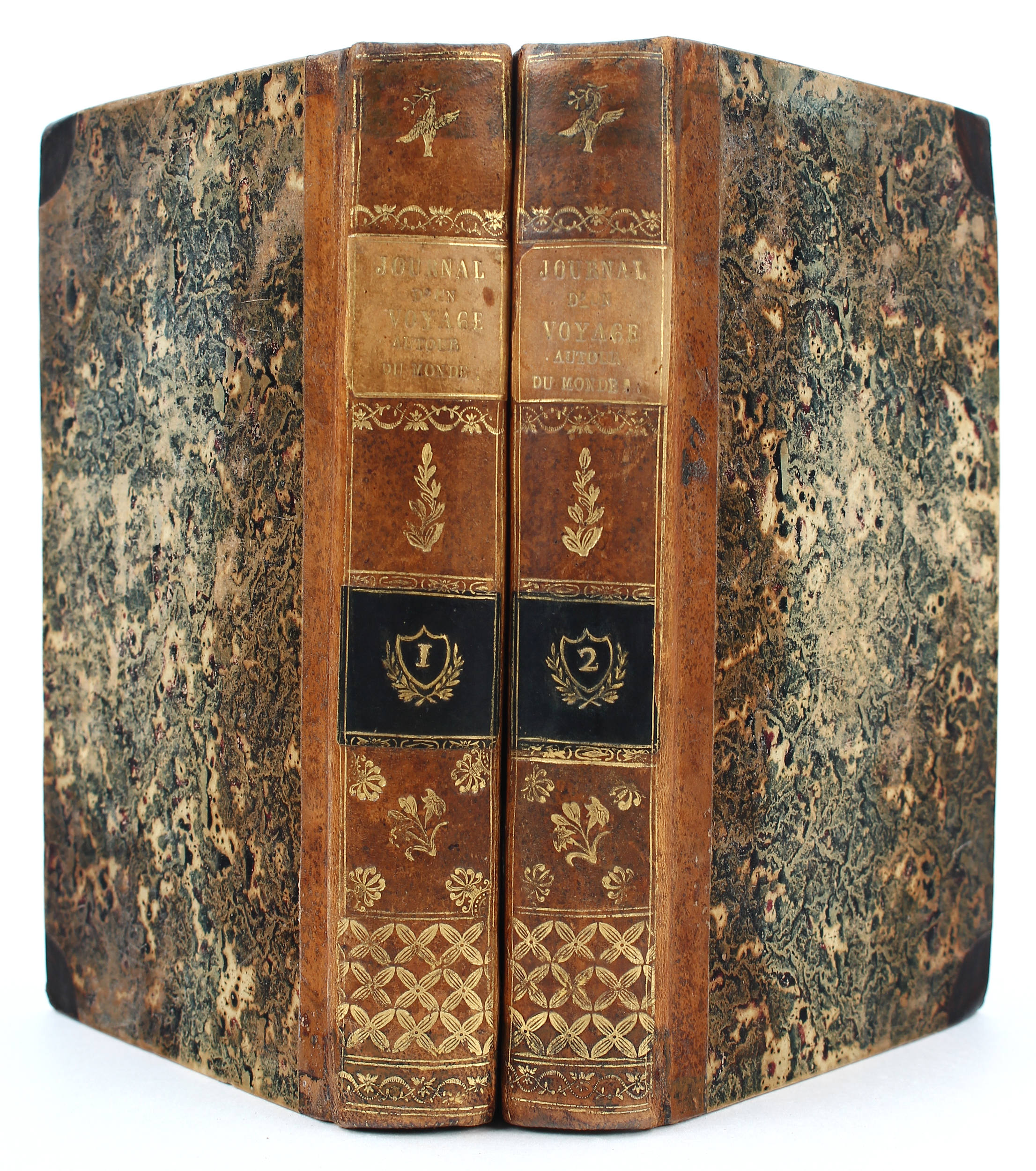
Title: Journal d'Un Voyage Autour du Monde, Pendant les Années 1816, 1817, 1818 et 1819 Author: Rocquefeuil, Camille de Place: Paris Publisher: Ponthieu, et al. Date: 1823 Description: 2 volumes. xlix, [1]. 344; [4], 407 pp. With 2 folding engraved maps. (8vo) 20.1x12 cm (8x4¾"), modern quarter morocco & marbled boards, spines tooled in gilt & blind, titled in gilt, marbled endpapers. First Edition. Rare first edition of this account of the third French circumnavigation, which included a sojourn in California and the Northwest Coast. The object of this voyage was the revival of trade in the North Pacific.Roquefeuil led the first French expedition to the Pacific since Baudin (1800-1804), the hiatus due to the interruptions of the Revolution and Napoleon's concentration on European conquests. He left Bordeaux in the Bordelais, sailing to the Pacific and the west coast of North America, attempting trade in California, Nootka, and Sitka, without financial success. Hill remarks that "Despite lack of profit, however, France now had an up-to-date report on conditions on the west coast of America from California to the Aleutians, on Hawaii, the Marquesas, and on the prospects for trade in each of these areas. In the section on the northwest coast of America, Roquefeuil gives many details of the Indian inhabitants." The two maps are: Mappe-Monde Pour servir au Voyagae au tour du Monde De Mr. Camille De Roquefeuil, Pendant les Années 1816, 1817, 1818 et 1819. Double hemisphere, 33x63 cm (short stub tear). Carte De La Côte Nord-Ouest D'Amerique pour servir au Voyage autour de Monde Par Monsr.Camille De Roquefeuil pendant les années 1816, 1817, 1818 et 1819. 34.2x28 cm. Further Notes from the Files of Warren Heckrotte Provenance: Maggs, 7/02 References: Cowan I p 195; Forbes 569; Hill 1483 (English ed); Howes R438 ("b"); Lada-Mocarski 86; Sabin 73149 I have a copy of the English translation, 1823, and also a separate copy of the map of the Northwest Coast which is an earlier state lacking the ship's tracks. The world map in this volume does not show the ship's tracks. However, the map in the 1843 reissue does show the ship's tracks; and I would guess in some copies of the first edition. There is a modern translation of those parts dealing with California; I have a copy. Roquefeuil's Journal was reissued in 1843 with new title pages and four plates (three of which were adapted from Meares), Forbes 1439. Roquefeuil first visited San Francisco in August 1817. He relates information on California told to him by Luis Arguella, commandant of the Presidio, who led an expedition up the Sacramento river in May of that year. He writes, "[Arguello] had gone as much as 50 leagues from it's mouth up the river San-Sacramento, which, as well as the San Joaquin, empties into this Mediterranean sea. The former comes from the northeast, the latter from the southeast." It was these two sentences that the French cartographer Brué used to construct his representation of these two rivers on several of his maps of 1824 and 1825, and I believe the first cartographic representation on a printed map of these two rivers and their relation to San Francisco Bay. Other information on these maps also comes from Roquefeuil. The word "Ichthiophages" meaning fish eaters was how Arguello described the Indians in the Delta area. On a later visit to California, Roquefeuil stopped at Bodega bay. From his contact with two Aleuts of the Russian American Company, one of whom spoke Spanish, came the information of the Slavinska Ross - Russian River - which is located on the maps of Brué. Lot Amendments Condition: Some very faint foxing and marginal toning within; title pages with circular patches from removal of inkstamps; very good or better in fine bindings. Item number: 266925
Title: Journal d'Un Voyage Autour du Monde, Pendant les Années 1816, 1817, 1818 et 1819 Author: Rocquefeuil, Camille de Place: Paris Publisher: Ponthieu, et al. Date: 1823 Description: 2 volumes. xlix, [1]. 344; [4], 407 pp. With 2 folding engraved maps. (8vo) 20.1x12 cm (8x4¾"), modern quarter morocco & marbled boards, spines tooled in gilt & blind, titled in gilt, marbled endpapers. First Edition. Rare first edition of this account of the third French circumnavigation, which included a sojourn in California and the Northwest Coast. The object of this voyage was the revival of trade in the North Pacific.Roquefeuil led the first French expedition to the Pacific since Baudin (1800-1804), the hiatus due to the interruptions of the Revolution and Napoleon's concentration on European conquests. He left Bordeaux in the Bordelais, sailing to the Pacific and the west coast of North America, attempting trade in California, Nootka, and Sitka, without financial success. Hill remarks that "Despite lack of profit, however, France now had an up-to-date report on conditions on the west coast of America from California to the Aleutians, on Hawaii, the Marquesas, and on the prospects for trade in each of these areas. In the section on the northwest coast of America, Roquefeuil gives many details of the Indian inhabitants." The two maps are: Mappe-Monde Pour servir au Voyagae au tour du Monde De Mr. Camille De Roquefeuil, Pendant les Années 1816, 1817, 1818 et 1819. Double hemisphere, 33x63 cm (short stub tear). Carte De La Côte Nord-Ouest D'Amerique pour servir au Voyage autour de Monde Par Monsr.Camille De Roquefeuil pendant les années 1816, 1817, 1818 et 1819. 34.2x28 cm. Further Notes from the Files of Warren Heckrotte Provenance: Maggs, 7/02 References: Cowan I p 195; Forbes 569; Hill 1483 (English ed); Howes R438 ("b"); Lada-Mocarski 86; Sabin 73149 I have a copy of the English translation, 1823, and also a separate copy of the map of the Northwest Coast which is an earlier state lacking the ship's tracks. The world map in this volume does not show the ship's tracks. However, the map in the 1843 reissue does show the ship's tracks; and I would guess in some copies of the first edition. There is a modern translation of those parts dealing with California; I have a copy. Roquefeuil's Journal was reissued in 1843 with new title pages and four plates (three of which were adapted from Meares), Forbes 1439. Roquefeuil first visited San Francisco in August 1817. He relates information on California told to him by Luis Arguella, commandant of the Presidio, who led an expedition up the Sacramento river in May of that year. He writes, "[Arguello] had gone as much as 50 leagues from it's mouth up the river San-Sacramento, which, as well as the San Joaquin, empties into this Mediterranean sea. The former comes from the northeast, the latter from the southeast." It was these two sentences that the French cartographer Brué used to construct his representation of these two rivers on several of his maps of 1824 and 1825, and I believe the first cartographic representation on a printed map of these two rivers and their relation to San Francisco Bay. Other information on these maps also comes from Roquefeuil. The word "Ichthiophages" meaning fish eaters was how Arguello described the Indians in the Delta area. On a later visit to California, Roquefeuil stopped at Bodega bay. From his contact with two Aleuts of the Russian American Company, one of whom spoke Spanish, came the information of the Slavinska Ross - Russian River - which is located on the maps of Brué. Lot Amendments Condition: Some very faint foxing and marginal toning within; title pages with circular patches from removal of inkstamps; very good or better in fine bindings. Item number: 266925


.jpg)


Testen Sie LotSearch und seine Premium-Features 7 Tage - ohne Kosten!
Lassen Sie sich automatisch über neue Objekte in kommenden Auktionen benachrichtigen.
Suchauftrag anlegen