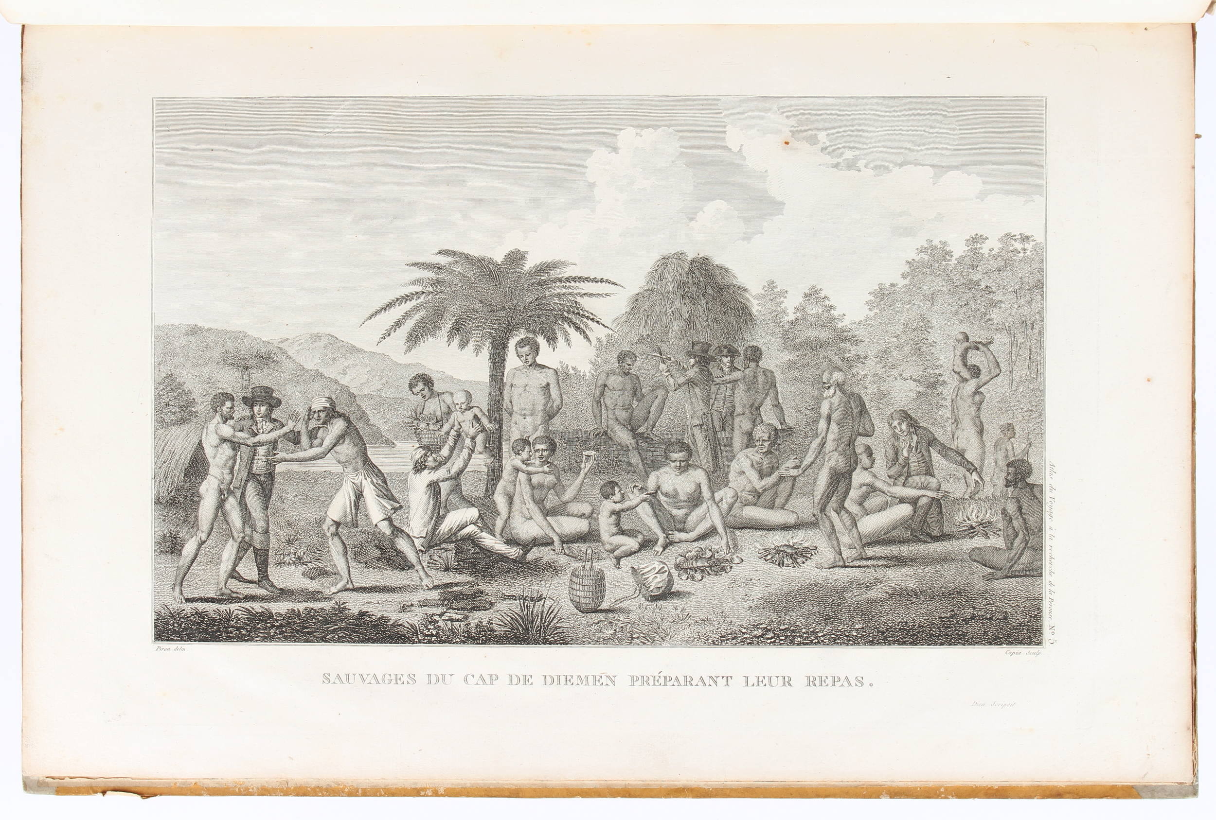
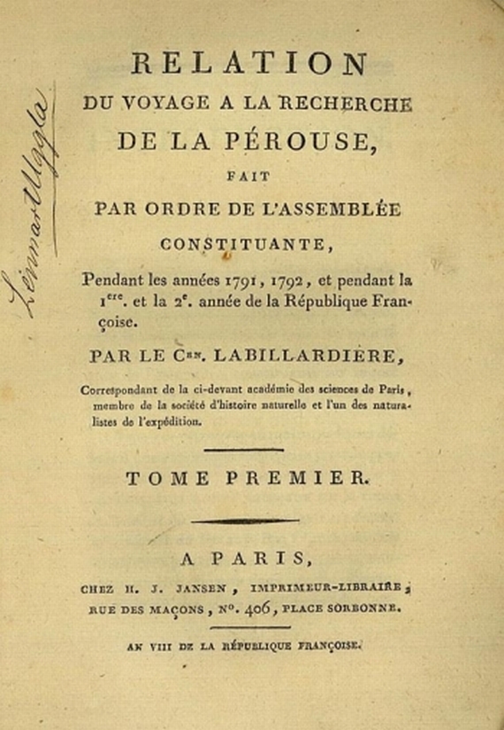
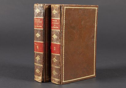
La Billardière, (J. J. H. de). Relation du voyage à la recherche de La Pérouse (&) Atlas pour servir à la relation du voyage à la recherche de La Pérouse. 2 Text bde. u. Atlas. Paris, H. J. Jansen, 1799-1800, u. F. Schoell, 1811 (Atlas). 4to (29:22,5) u. Gr.- fol. (56,5:39 cm ). Mit gest. Titel, 1 gefalt. Kupferkarte u. 43 Kupfertafeln. XVI, 44 2 S. ; 332, 11 3 S. Hldr. d. Zt. mit Rsch. u. mod. Hlwd (Atlas), berieben und bestoßen u. mit einigen kl. Fehlstellen; Atlas stärker beschabt, Rücken erneuert unter Verwendung alten Materials, Innengelenke angebrochen (Text) oder mit Textilband verstärkt (Atlas). ( ) Erste Ausgabe. - Sabin 38420; Du Rietz 697; Ferguson 307; Monglond V, 197; Cox I, 68. - Quartausgabe, Exemplar auf größerem Papier. "Some copies of the work are issued on large paper" (Ferguson). Das Werk behandelt die vergebliche Suche unter d'Entrecasteaux u. Kermadec nach der verschollenen La Pérouse-Expedition. Die Faltkarte zeigt den Indischen Ozean mit der Schiffsroute, auf der die Expedition unter dem Kommando von Dentrecasteaux die Küsten von Tasmanien, Neukaledonien, Neuguinea, Australien, den Tonga- und anderen Inseln untersuchte. Die Tafeln zeigen Ansichten, Eingeborene, Werkzeuge u. Waffen, Vögel sowie 14 Pflanzendarstellungen nach Rédouté. - Etwas gebräunt u. tls. stockfl. (Text), stockfl. u. tls. wasserfl. (Atlas), Karte mit leichten Quetschfalten, kl. Schabstelle im weißen Rand, Falz hinterlegt. First edition. - Quarto edition, simultaneously issued in octavo. Large paper copy. "The expedition made several important contributions to geographical knowledge, and the investigations of the naturalists into the productions of countries visited were of special value" (Ferguson). The expedition under the command of Dentrecasteaux surveyed the coasts of Tasmania, New Caledonia, the north coast of New Guinea, south-west coast of Australia, the Tonga and other islands. With 1 engr. folding map, showing the track of the vessels, and 43 engraved plates, depicting views, natives, birds and plants. - Staining and browning to text, staining and dampstaining to atlas, some crease to map, minimal exposure to white margin of map, strengthening to fold, inner hinges cracked but sound (text) or repaired (atlas). Bound in contemp. half-calf (text) or mod. half-cloth by using old material, some rubbing with minor exposure to cover.
La Billardière, (J. J. H. de). Relation du voyage à la recherche de La Pérouse (&) Atlas pour servir à la relation du voyage à la recherche de La Pérouse. 2 Text bde. u. Atlas. Paris, H. J. Jansen, 1799-1800, u. F. Schoell, 1811 (Atlas). 4to (29:22,5) u. Gr.- fol. (56,5:39 cm ). Mit gest. Titel, 1 gefalt. Kupferkarte u. 43 Kupfertafeln. XVI, 44 2 S. ; 332, 11 3 S. Hldr. d. Zt. mit Rsch. u. mod. Hlwd (Atlas), berieben und bestoßen u. mit einigen kl. Fehlstellen; Atlas stärker beschabt, Rücken erneuert unter Verwendung alten Materials, Innengelenke angebrochen (Text) oder mit Textilband verstärkt (Atlas). ( ) Erste Ausgabe. - Sabin 38420; Du Rietz 697; Ferguson 307; Monglond V, 197; Cox I, 68. - Quartausgabe, Exemplar auf größerem Papier. "Some copies of the work are issued on large paper" (Ferguson). Das Werk behandelt die vergebliche Suche unter d'Entrecasteaux u. Kermadec nach der verschollenen La Pérouse-Expedition. Die Faltkarte zeigt den Indischen Ozean mit der Schiffsroute, auf der die Expedition unter dem Kommando von Dentrecasteaux die Küsten von Tasmanien, Neukaledonien, Neuguinea, Australien, den Tonga- und anderen Inseln untersuchte. Die Tafeln zeigen Ansichten, Eingeborene, Werkzeuge u. Waffen, Vögel sowie 14 Pflanzendarstellungen nach Rédouté. - Etwas gebräunt u. tls. stockfl. (Text), stockfl. u. tls. wasserfl. (Atlas), Karte mit leichten Quetschfalten, kl. Schabstelle im weißen Rand, Falz hinterlegt. First edition. - Quarto edition, simultaneously issued in octavo. Large paper copy. "The expedition made several important contributions to geographical knowledge, and the investigations of the naturalists into the productions of countries visited were of special value" (Ferguson). The expedition under the command of Dentrecasteaux surveyed the coasts of Tasmania, New Caledonia, the north coast of New Guinea, south-west coast of Australia, the Tonga and other islands. With 1 engr. folding map, showing the track of the vessels, and 43 engraved plates, depicting views, natives, birds and plants. - Staining and browning to text, staining and dampstaining to atlas, some crease to map, minimal exposure to white margin of map, strengthening to fold, inner hinges cracked but sound (text) or repaired (atlas). Bound in contemp. half-calf (text) or mod. half-cloth by using old material, some rubbing with minor exposure to cover.

.jpg?w=400)

.jpg)
.jpg)


Testen Sie LotSearch und seine Premium-Features 7 Tage - ohne Kosten!
Lassen Sie sich automatisch über neue Objekte in kommenden Auktionen benachrichtigen.
Suchauftrag anlegen