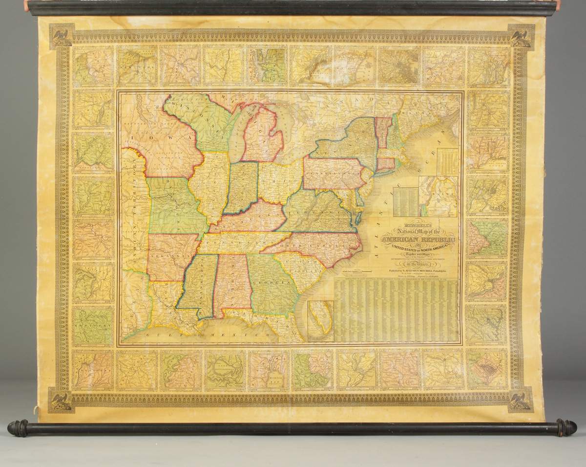
Title: Mitchell's National Map of the American Republic of United States of North America, Together with maps of the Vicinities of Thirty-Two of the Principal Cities and Towns in the Union Author: Mitchell, Samuel Augustus Place: Philadelphia Publisher: S. Augustus Mitchell Date: 1844 Description: Engraved wall map, hand-colored. Drawn by J.H. Young, Engraved by J.H. Brightly. 92.5x116 cm (36½x45½") including the surrounding vicinity maps and decorative borders; mounted on linen backing, wooden rollers at top and bottom. A handsome and uncommon wall map, very detailed with numerous place names, plus roads, villages, railroads, ports, etc. A table gives the 1840 population of hundreds of cities. The map is surrounded by a wide decorative border, which surrounds another border composed of the regional areas of 32 important cities. The map extends west to include eastern Texas, part of a massive Indian Territory, and much of a very enlarged Iowa which extends to the Canadian border. With two inset maps: "Map of North-Eastern Boundary of the United States According to the Treaty of 1842" [i.e. Maine]; and "Map of Southern Part of Florida." Lot Amendments Condition: Some edge wear, monstly marginal, and fairly minor, damptaining, very good. Item number: 265954
Title: Mitchell's National Map of the American Republic of United States of North America, Together with maps of the Vicinities of Thirty-Two of the Principal Cities and Towns in the Union Author: Mitchell, Samuel Augustus Place: Philadelphia Publisher: S. Augustus Mitchell Date: 1844 Description: Engraved wall map, hand-colored. Drawn by J.H. Young, Engraved by J.H. Brightly. 92.5x116 cm (36½x45½") including the surrounding vicinity maps and decorative borders; mounted on linen backing, wooden rollers at top and bottom. A handsome and uncommon wall map, very detailed with numerous place names, plus roads, villages, railroads, ports, etc. A table gives the 1840 population of hundreds of cities. The map is surrounded by a wide decorative border, which surrounds another border composed of the regional areas of 32 important cities. The map extends west to include eastern Texas, part of a massive Indian Territory, and much of a very enlarged Iowa which extends to the Canadian border. With two inset maps: "Map of North-Eastern Boundary of the United States According to the Treaty of 1842" [i.e. Maine]; and "Map of Southern Part of Florida." Lot Amendments Condition: Some edge wear, monstly marginal, and fairly minor, damptaining, very good. Item number: 265954


Testen Sie LotSearch und seine Premium-Features 7 Tage - ohne Kosten!
Lassen Sie sich automatisch über neue Objekte in kommenden Auktionen benachrichtigen.
Suchauftrag anlegen