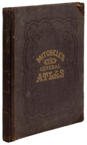
Title: Mitchell's New General Atlas, Containing Maps of the Various Countries of the World, Plans of Cities, Etc., Embraced in Ninety-Three Quarto Maps... Author: Mitchell, S[amuel] Augustus Place: Philadelphia Publisher: S. Augustus Mitchell Date: 1880 Description: With 78 hand-colored maps and plans plus several insets (23 are double-page, 1 of which is folding); all on 50 map-sheets; plus 3 other color plates showing the time table, East and West Hemisphere. 15¼x12½, original quarter calf and tan-brown cloth, stamped in black and gilt. Fifty-six of the maps pertain to the Americas, including most of the double-page maps, full-page map of the original 13 colonies, also of Alaska, Cuba, South American countries, etc. Lot Amendments Condition: Large tears to spine, rubbing; front hinge completely cracked through, occasional finger-soiling; double-page map of New Hampshire and Vermont loosely laid in with chips and tears; most maps very good or better, binding worn and in need of repair. Item number: 144425
Title: Mitchell's New General Atlas, Containing Maps of the Various Countries of the World, Plans of Cities, Etc., Embraced in Ninety-Three Quarto Maps... Author: Mitchell, S[amuel] Augustus Place: Philadelphia Publisher: S. Augustus Mitchell Date: 1880 Description: With 78 hand-colored maps and plans plus several insets (23 are double-page, 1 of which is folding); all on 50 map-sheets; plus 3 other color plates showing the time table, East and West Hemisphere. 15¼x12½, original quarter calf and tan-brown cloth, stamped in black and gilt. Fifty-six of the maps pertain to the Americas, including most of the double-page maps, full-page map of the original 13 colonies, also of Alaska, Cuba, South American countries, etc. Lot Amendments Condition: Large tears to spine, rubbing; front hinge completely cracked through, occasional finger-soiling; double-page map of New Hampshire and Vermont loosely laid in with chips and tears; most maps very good or better, binding worn and in need of repair. Item number: 144425


Testen Sie LotSearch und seine Premium-Features 7 Tage - ohne Kosten!
Lassen Sie sich automatisch über neue Objekte in kommenden Auktionen benachrichtigen.
Suchauftrag anlegen