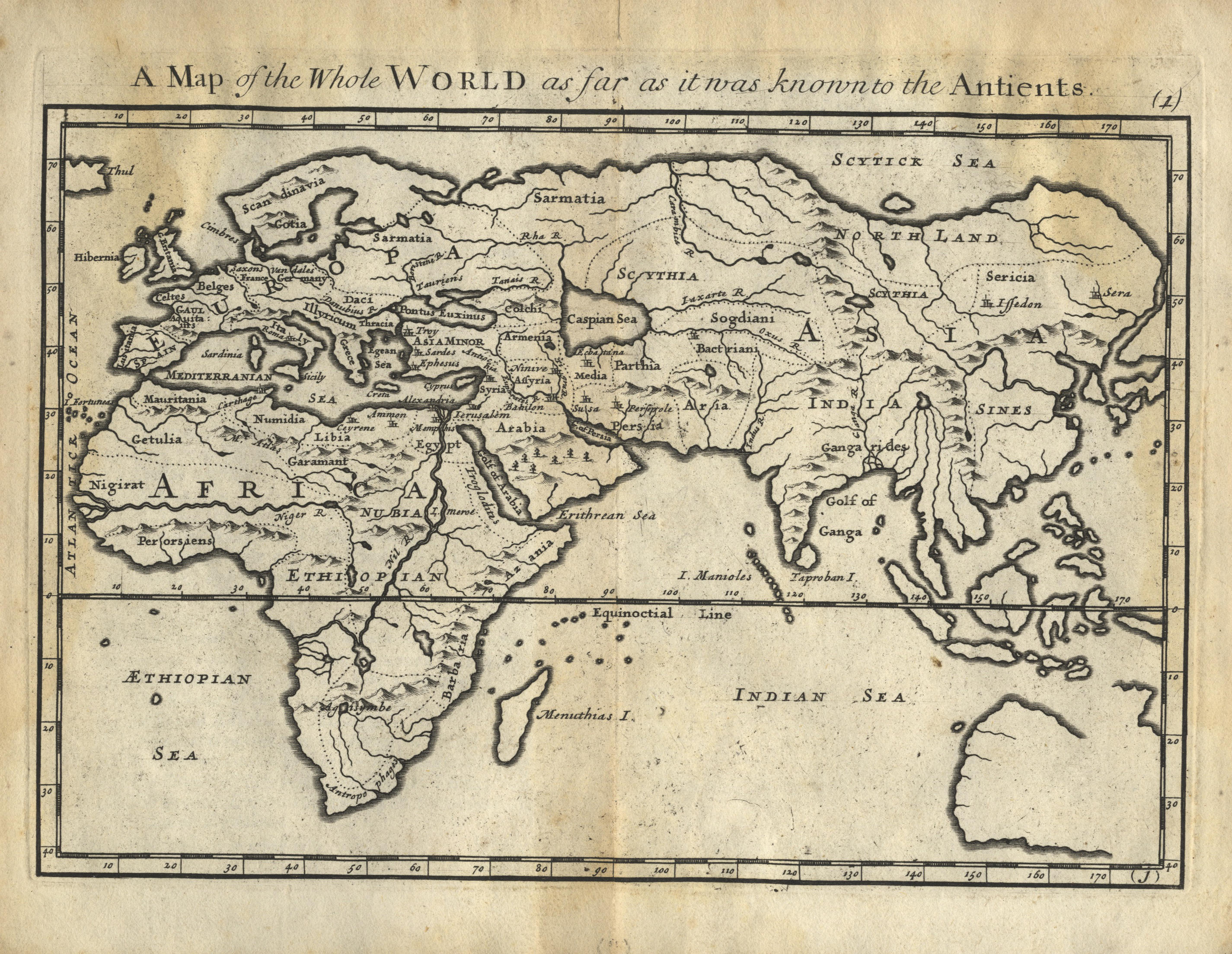
[Moll, Herman]. Geographia Classica: The Geography of the Ancients so far describ'd as it is contain'd in the Greek and Latin Classicks, in Twenty-nine Maps of the Old World ... a collection long wanted, and now publish'd for the use of schools, 2nd edition, London: printed for C. Browne, 1717, 29 double-page engraved maps (one folding), 4 with near contemporary hand-colouring, title printed in red & black, some dampstaining at head and fore-edges, map 15 with tear to lower margin (just affecting map border), map 16 close-trimmed at foot and fore-edges (affecting border & 1 place name), final map with 2 tiny losses, front free endpaper deficient, contemporary red quarter morocco, worn, small 4to, together with: Butler (Samuel), An Atlas of Ancient Geography, London: Longman & Co., circa 1839, 22 double-page engraved maps (complete), all but one hand-coloured in outline, engraved calligraphic title, 16pp. publisher's catalogue at rear dated August 1839, a few minor spots or marks, 4 maps with some pale brown staining, 1 map with closed tear to lower corner (affecting map border), front free endpaper with ink manuscript ownership name, dated 1840, contemporary red half morocco, worn, front cover with original engraved paper label, small 4to, with 7 others similar (some defective), including Walker's Universal Atlas for the use of schools, 1823, and Maps and Plans Illustrative of Livy, published J. Vincent, Oxford, circa 1850? (Qty: 9) First item: ESTC T222277.
[Moll, Herman]. Geographia Classica: The Geography of the Ancients so far describ'd as it is contain'd in the Greek and Latin Classicks, in Twenty-nine Maps of the Old World ... a collection long wanted, and now publish'd for the use of schools, 2nd edition, London: printed for C. Browne, 1717, 29 double-page engraved maps (one folding), 4 with near contemporary hand-colouring, title printed in red & black, some dampstaining at head and fore-edges, map 15 with tear to lower margin (just affecting map border), map 16 close-trimmed at foot and fore-edges (affecting border & 1 place name), final map with 2 tiny losses, front free endpaper deficient, contemporary red quarter morocco, worn, small 4to, together with: Butler (Samuel), An Atlas of Ancient Geography, London: Longman & Co., circa 1839, 22 double-page engraved maps (complete), all but one hand-coloured in outline, engraved calligraphic title, 16pp. publisher's catalogue at rear dated August 1839, a few minor spots or marks, 4 maps with some pale brown staining, 1 map with closed tear to lower corner (affecting map border), front free endpaper with ink manuscript ownership name, dated 1840, contemporary red half morocco, worn, front cover with original engraved paper label, small 4to, with 7 others similar (some defective), including Walker's Universal Atlas for the use of schools, 1823, and Maps and Plans Illustrative of Livy, published J. Vincent, Oxford, circa 1850? (Qty: 9) First item: ESTC T222277.


Testen Sie LotSearch und seine Premium-Features 7 Tage - ohne Kosten!
Lassen Sie sich automatisch über neue Objekte in kommenden Auktionen benachrichtigen.
Suchauftrag anlegen