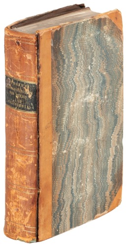
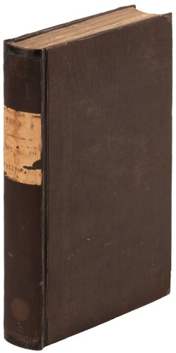
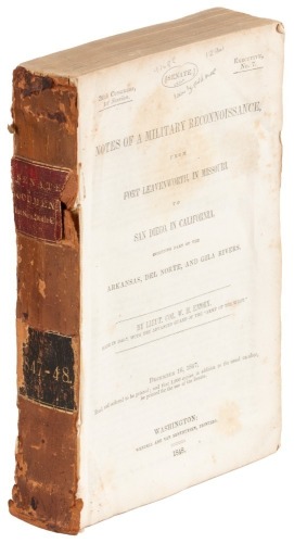
Title: Notes of a Military Reconnoissance, from Fort Leavenworth, in Missouri, to San Diego, in California, Including Part of the Arkansas, Del Norte, and Gila Rivers Author: Emory, Lieut. Col. W[illiam] H. Place: Washington DC Publisher: Wendell & Van Benthuysen Date: 1848 Description: 416 pp. Illustrated with 43 lithographed plates, including 3 battle-plans and 14 plant plates; plus 1 large folding map "Military Reconnaissance of the Arkansas Ro Del Norte and Rio Gila" (30x63"), placed inside a separate custom-made cloth-backed chemise folder with a paper spine label. 8¾x5½, original brown cloth, rebacked with original cloth and paper spine label, new endpapers, hinges reinforced. First Edition, Senate Issue 2. This is the second Senate issue of the book, with Emory's rank given as Brevet Major, and with slight changes in the spelling of the captions. However, it does contain the large folding map, which Wagner-Camp does not call for in this issue. A superb study by topographical engineer and scientist Emory of the lands newly wrested from the Mexican government. As Wagner-Camp notes, "his report was a major contribution to the geographical knowledge of North America. His map, in which he limited himself to recording only the data which he and his assistants had actually observed, was the first accurate depiction of that vast area, and is still regarded as one of the landmarks of American cartography. The report includes sections on the plants and animals, as well as on the geology and the prehistoric town sites and other archeological remains. Emory's descriptions of the various Indian tribes that he encountered were steps toward the newly-forming discipline -Anthropology- concerned with primitive man." The large map is called by Wheat "a document of towering significance in the cartographic history of the West," and "epoch-making." Although Howes gives precedence to the larger House issue, Wagner-Camp lists this issue as the first; the latter does, however, admit that the various issues and editions have "caused much distress among bibliographers and scholars for many years." Senate Executive No. 7, 30th Congress, 1st Session. Cowan p.195; Graff 1249; Howes E145; Wagner-Camp 148:2; Zamorano Eighty 33. Lot Amendments Condition: Edge wear and rubbing to cloth; slight foxing and darkening to contents; the right-most quarter of entire folding map separated along fold (but present), plus general toning and a few splits to map, which is still good; else volume very good. Item number: 155115
Title: Notes of a Military Reconnoissance, from Fort Leavenworth, in Missouri, to San Diego, in California, Including Part of the Arkansas, Del Norte, and Gila Rivers Author: Emory, Lieut. Col. W[illiam] H. Place: Washington DC Publisher: Wendell & Van Benthuysen Date: 1848 Description: 416 pp. Illustrated with 43 lithographed plates, including 3 battle-plans and 14 plant plates; plus 1 large folding map "Military Reconnaissance of the Arkansas Ro Del Norte and Rio Gila" (30x63"), placed inside a separate custom-made cloth-backed chemise folder with a paper spine label. 8¾x5½, original brown cloth, rebacked with original cloth and paper spine label, new endpapers, hinges reinforced. First Edition, Senate Issue 2. This is the second Senate issue of the book, with Emory's rank given as Brevet Major, and with slight changes in the spelling of the captions. However, it does contain the large folding map, which Wagner-Camp does not call for in this issue. A superb study by topographical engineer and scientist Emory of the lands newly wrested from the Mexican government. As Wagner-Camp notes, "his report was a major contribution to the geographical knowledge of North America. His map, in which he limited himself to recording only the data which he and his assistants had actually observed, was the first accurate depiction of that vast area, and is still regarded as one of the landmarks of American cartography. The report includes sections on the plants and animals, as well as on the geology and the prehistoric town sites and other archeological remains. Emory's descriptions of the various Indian tribes that he encountered were steps toward the newly-forming discipline -Anthropology- concerned with primitive man." The large map is called by Wheat "a document of towering significance in the cartographic history of the West," and "epoch-making." Although Howes gives precedence to the larger House issue, Wagner-Camp lists this issue as the first; the latter does, however, admit that the various issues and editions have "caused much distress among bibliographers and scholars for many years." Senate Executive No. 7, 30th Congress, 1st Session. Cowan p.195; Graff 1249; Howes E145; Wagner-Camp 148:2; Zamorano Eighty 33. Lot Amendments Condition: Edge wear and rubbing to cloth; slight foxing and darkening to contents; the right-most quarter of entire folding map separated along fold (but present), plus general toning and a few splits to map, which is still good; else volume very good. Item number: 155115


Testen Sie LotSearch und seine Premium-Features 7 Tage - ohne Kosten!
Lassen Sie sich automatisch über neue Objekte in kommenden Auktionen benachrichtigen.
Suchauftrag anlegen