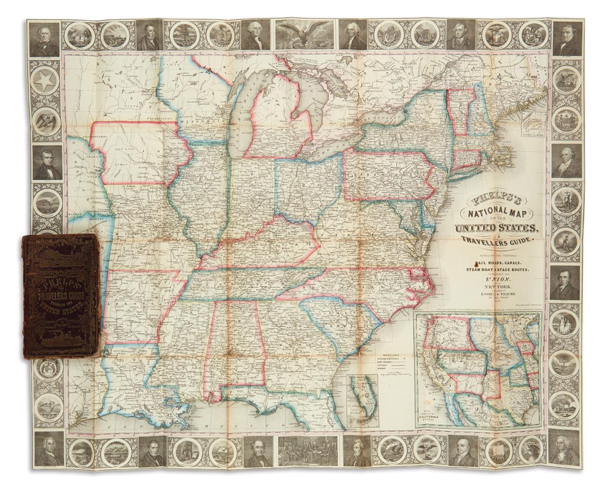
Title: Phelps's Travellers' Guide Through the United States; Containing Upwards of Seven Hundred Rail-Road, Canal, and Stage and Steam-boat Routes. Accompanied with a New Map of the United States Author: Ensigns & Thayer Place: New York Publisher: Ensigns & Thayer Date: 1849 Description: [2], 70 pp. With hand-colored folding engraved map of the eastern half of the United States, with a border of engraved vignettes of patriots and state seals. 13.8x8.3 cm. (5½x3¼"), original full red straight-grain roan pictorially stamped in gilt on front cover, in blind on rear, all edges gilt. The map is dated 1848, and measures 53.5x64.5 cm. (21x25½"). Engraved by J.M. Atwood. With insets of the cities of New York, Boston, Philadelphia, Pittsburgh, Cincinnati, St. Louis, Chicago and Baltimore along with one of the Florida peninsula. Lot Amendments Condition: A little rubbing to volume extremities, map detached, with two small stains at left hand portion, very good or better. Item number: 221730
Title: Phelps's Travellers' Guide Through the United States; Containing Upwards of Seven Hundred Rail-Road, Canal, and Stage and Steam-boat Routes. Accompanied with a New Map of the United States Author: Ensigns & Thayer Place: New York Publisher: Ensigns & Thayer Date: 1849 Description: [2], 70 pp. With hand-colored folding engraved map of the eastern half of the United States, with a border of engraved vignettes of patriots and state seals. 13.8x8.3 cm. (5½x3¼"), original full red straight-grain roan pictorially stamped in gilt on front cover, in blind on rear, all edges gilt. The map is dated 1848, and measures 53.5x64.5 cm. (21x25½"). Engraved by J.M. Atwood. With insets of the cities of New York, Boston, Philadelphia, Pittsburgh, Cincinnati, St. Louis, Chicago and Baltimore along with one of the Florida peninsula. Lot Amendments Condition: A little rubbing to volume extremities, map detached, with two small stains at left hand portion, very good or better. Item number: 221730


Testen Sie LotSearch und seine Premium-Features 7 Tage - ohne Kosten!
Lassen Sie sich automatisch über neue Objekte in kommenden Auktionen benachrichtigen.
Suchauftrag anlegen