POWNALL, Thomas (1722-1805). A Topographical Description of Such Parts of North America as are Contained in the (Annexed) Map of the Middle British Colonies in North America . London: for J. Almon, 1776.
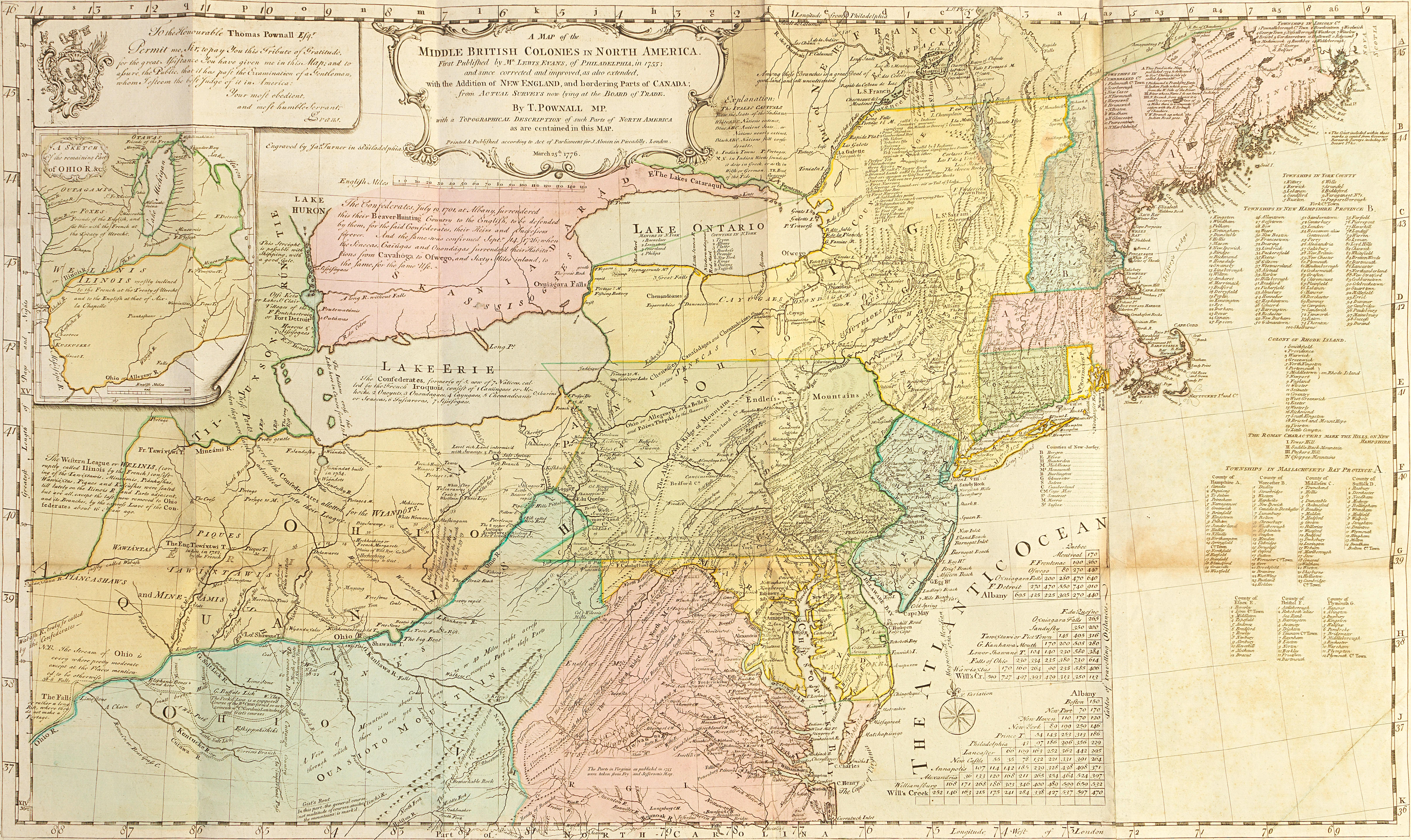
POWNALL, Thomas (1722-1805). A Topographical Description of Such Parts of North America as are Contained in the (Annexed) Map of the Middle British Colonies in North America . London: for J. Almon, 1776. 2° (417 x 250 mm). LARGE ENGRAVED FOLDING MAP printed on two sheets, "A Map of the Middle British Colonies in North America. First Published by Mr. Lewis Evans, of and since corrected and improved, as also extended, with the addition of New England, and bordering parts of Canada; from actual surveys ... by T. Pownall ...March 25th, 1776" (495 x 830 mm plate, 534 x 895 mm sheet), outline coloring in a contemporary hand. (Some light marginal staining, primarily to text leaves.) Contemporary half calf, spine gilt, green lettering-piece gilt, marbled boards (some light wear, spine ends and upper joint skillfully renewed, lower joint starting). FIRST EDITION. Pownall’s map incorporates significant revisions of Evans’ important 1755 A General Map of the Middle British Colonies, in America , with significant detail added, including the route of Christopher Gist's 1750-1751 trek through the unexplored areas of Kentucky, West Virginia and Ohio. The full text of Gist's journal is printed in Appendix VI of Pownall's Description . The explorations of Captain Harry Gordon in 1766, from Fort Pitt down the Ohio River into the Illinois territory, are also depicted, and an account of his journey appears in Pownall's Appendix IV with the narratives of others: Captain Anthony Von Schaik (1756), Captain Humphrey Hobbs (1756) and Lewis Evans (1743). See Cumming, British Maps of Colonial America , pp. 26, 30; Buck, Illinois 289; Howes P-543; Phillips, Maps of America , p. 575; Sabin 64835; Streeter Sale 2:826; Thomson, Ohio 940; Vail 651.

.jpg)


Testen Sie LotSearch und seine Premium-Features 7 Tage - ohne Kosten!
Lassen Sie sich automatisch über neue Objekte in kommenden Auktionen benachrichtigen.
Suchauftrag anlegen