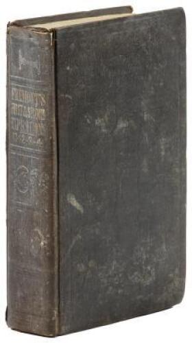
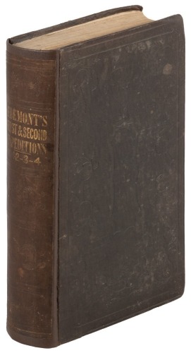
Title: Report of the Exploring Expedition to the Rocky Mountains in the Year 1842, and to Oregon and North California in the Years 1843-'44 Author: Frémont, John Charles Place: Washington Publisher: Gales & Seaton Date: 1845 Description: 693 pp. Complete with 22 lithograph plates; 5 maps, 3 of them folding (including 1 loose in rear endpaper pocket). (8vo) 22.7x18 cm (9x5½"), original blindstamped brown cloth rebacked with original spine laid down, spine lettered in gilt. First Edition, Senate Issue. J.C. Frémont's most important work, chronicling his seminal expeditions that revealed the paths and trails that were to be the highways by which the gold seekers would rush to California beginning in 1849, with his important large map of the West. The first portion of the work reprints Frémont's report of 1843, covering his 1842 expedition to the Rocky Mountains, the second portion records his expedition of 1843-1844, delineating the major sections of the route subsequently followed by thousands of Oregon immigrants. This Senate issue contains scientific data not present in the smaller House issue. There are five maps in the work: Untitled emigrant route in Bear River Valley, 47x23 cm; Beer Springs, 23x14 cm; The Great Salt Lake, 23x14 cm; Untitled map of the crossing of the Sierra Nevada by the South Fork of the American River, 23x64 cm; and Map of an Exploring Expedition to the Rocky Mountains in the Year 1842 and to Oregon & North California in the years 1843-44, 76x131 cm. Wheat describes this latter map at great length, and attaches great importance to it: "The year 1845, however, though otherwise somewhat cartographically barren, because of a single event is in fact one of the towering years in the story of Western Cartography. In that year John C. Frémont's report of his journey to Oregon and California in 1843-44 was published. This report and the Frémont (Preuss) map which accompanied it, changed the entire picture of the West, and made a lasting contribution to cartography...." Cowan p.223-4; Graff 1436; Howes F370; Wagner-Camp 115:1; Wheat Transmississippi Vol. II, pp.194-200, Map 497; Wheat Gold Rush 21; Zamorano Eighty 39. Lot Amendments Condition: Some wear to cloth, rubbing to spine gilt; toning to endpapers, libray bookplate on front paste-down page, archival tape on verso of loose map, scattered foxing to text and plates; very good. Item number: 269511
Title: Report of the Exploring Expedition to the Rocky Mountains in the Year 1842, and to Oregon and North California in the Years 1843-'44 Author: Frémont, John Charles Place: Washington Publisher: Gales & Seaton Date: 1845 Description: 693 pp. Complete with 22 lithograph plates; 5 maps, 3 of them folding (including 1 loose in rear endpaper pocket). (8vo) 22.7x18 cm (9x5½"), original blindstamped brown cloth rebacked with original spine laid down, spine lettered in gilt. First Edition, Senate Issue. J.C. Frémont's most important work, chronicling his seminal expeditions that revealed the paths and trails that were to be the highways by which the gold seekers would rush to California beginning in 1849, with his important large map of the West. The first portion of the work reprints Frémont's report of 1843, covering his 1842 expedition to the Rocky Mountains, the second portion records his expedition of 1843-1844, delineating the major sections of the route subsequently followed by thousands of Oregon immigrants. This Senate issue contains scientific data not present in the smaller House issue. There are five maps in the work: Untitled emigrant route in Bear River Valley, 47x23 cm; Beer Springs, 23x14 cm; The Great Salt Lake, 23x14 cm; Untitled map of the crossing of the Sierra Nevada by the South Fork of the American River, 23x64 cm; and Map of an Exploring Expedition to the Rocky Mountains in the Year 1842 and to Oregon & North California in the years 1843-44, 76x131 cm. Wheat describes this latter map at great length, and attaches great importance to it: "The year 1845, however, though otherwise somewhat cartographically barren, because of a single event is in fact one of the towering years in the story of Western Cartography. In that year John C. Frémont's report of his journey to Oregon and California in 1843-44 was published. This report and the Frémont (Preuss) map which accompanied it, changed the entire picture of the West, and made a lasting contribution to cartography...." Cowan p.223-4; Graff 1436; Howes F370; Wagner-Camp 115:1; Wheat Transmississippi Vol. II, pp.194-200, Map 497; Wheat Gold Rush 21; Zamorano Eighty 39. Lot Amendments Condition: Some wear to cloth, rubbing to spine gilt; toning to endpapers, libray bookplate on front paste-down page, archival tape on verso of loose map, scattered foxing to text and plates; very good. Item number: 269511

.jpg)


.jpg)


Testen Sie LotSearch und seine Premium-Features 7 Tage - ohne Kosten!
Lassen Sie sich automatisch über neue Objekte in kommenden Auktionen benachrichtigen.
Suchauftrag anlegen