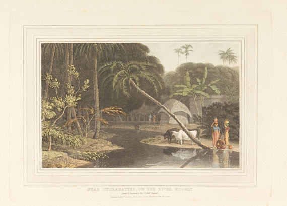
THOMAS DANIELL (1749-1840) and WILLIAM DANIELL (1769-1837) Raje Gaut, The Principal Road up to Rotas Ghur, Bahar Ousoor, in the Mysore View from the Ruins of the Fort of Currah, on the River Ganges View in the Koah Nullah View near Daramundi, in the Mountains of Serinagur View on the Ram-Gunga, Between Buddell & Bilkate View taken between Natan & Taka Ca Munda, Sirinagur Mountains Between Taka Ca Munda and Sirinagur View taken near the City of Sirinagur 9 hand-coloured aquatints, drawn and engraved by Thomas Daniell on thick Whatman paper (535 x 715mm to 540 x 755mm), dated 1795-1805, from Thomas and William Daniell's Oriental Scenery , London: 1795-1807[8], first plate with plate number supplied in pencil, one plate mounted (minor marginal wear to a few plates, upper left corner to final plate torn with loss not affecting image). Abbey Travel 420, nos. 6, 90, 97, 141, 143, 146-8, 150. Exhibited : 2 plates, India Observed , nos. 83, 87. An impressive group of views from the Daniells' magnificent work, Oriental Scenery . The plates are from parts I, IV and VI and comprise views first drawn by the Daniells on their first and second tours of India. Except for 'Ousoor, in the Mysore', all of the plates here resulted from The First Tour, of 'The Ganges', which took place from August 1788 to November 1791. The view of Ousoor was first drawn on The Second Tour, of 'The South', which took place from March 1792 to February 1793. The Daniells came across the hill fort of Currah (Kara) in October 1789, as they were setting out on their return journey by river. Impressed by the scenery near Kara, William Daniell described the fort in his journal, 'What appears in this view was formerly part of a gateway. From this spot the view down the river Ganges has a good effect, the banks are well clothed with Mango topes, or groves, richly interspersed with buildings, boats etc.' Archer notes that Thomas Daniell delighted in 'singular' forms, 'which were valued in the new aesthetic approach to landscape, and this scene was clearly chosen because of the interesting shape of the ruin'. The Daniells journeyed through the Srinagar Mountains in April 1789, drawing views along the rocky valley of the Khoh river, 'the scenes the whole way of the most romantic kind - impassable for any animal. We.. were carried in our Jampans by four Bearers... saw many villages & much cultivation on the tops of the hills' (Journal). Greatly impressed by these ranges of mountains, they thought 'it would be in vain to attempt.. to convey an idea of those sublime effects, which perhaps even the finest art can but vainly imitate.' By February 1790 the Daniells reached Rotas Ghur, 'the most considerable hill fort of this part of India; it is naturally of great strength, and the weaker parts have been assisted by very strong works' (Journal). (9)
THOMAS DANIELL (1749-1840) and WILLIAM DANIELL (1769-1837) Raje Gaut, The Principal Road up to Rotas Ghur, Bahar Ousoor, in the Mysore View from the Ruins of the Fort of Currah, on the River Ganges View in the Koah Nullah View near Daramundi, in the Mountains of Serinagur View on the Ram-Gunga, Between Buddell & Bilkate View taken between Natan & Taka Ca Munda, Sirinagur Mountains Between Taka Ca Munda and Sirinagur View taken near the City of Sirinagur 9 hand-coloured aquatints, drawn and engraved by Thomas Daniell on thick Whatman paper (535 x 715mm to 540 x 755mm), dated 1795-1805, from Thomas and William Daniell's Oriental Scenery , London: 1795-1807[8], first plate with plate number supplied in pencil, one plate mounted (minor marginal wear to a few plates, upper left corner to final plate torn with loss not affecting image). Abbey Travel 420, nos. 6, 90, 97, 141, 143, 146-8, 150. Exhibited : 2 plates, India Observed , nos. 83, 87. An impressive group of views from the Daniells' magnificent work, Oriental Scenery . The plates are from parts I, IV and VI and comprise views first drawn by the Daniells on their first and second tours of India. Except for 'Ousoor, in the Mysore', all of the plates here resulted from The First Tour, of 'The Ganges', which took place from August 1788 to November 1791. The view of Ousoor was first drawn on The Second Tour, of 'The South', which took place from March 1792 to February 1793. The Daniells came across the hill fort of Currah (Kara) in October 1789, as they were setting out on their return journey by river. Impressed by the scenery near Kara, William Daniell described the fort in his journal, 'What appears in this view was formerly part of a gateway. From this spot the view down the river Ganges has a good effect, the banks are well clothed with Mango topes, or groves, richly interspersed with buildings, boats etc.' Archer notes that Thomas Daniell delighted in 'singular' forms, 'which were valued in the new aesthetic approach to landscape, and this scene was clearly chosen because of the interesting shape of the ruin'. The Daniells journeyed through the Srinagar Mountains in April 1789, drawing views along the rocky valley of the Khoh river, 'the scenes the whole way of the most romantic kind - impassable for any animal. We.. were carried in our Jampans by four Bearers... saw many villages & much cultivation on the tops of the hills' (Journal). Greatly impressed by these ranges of mountains, they thought 'it would be in vain to attempt.. to convey an idea of those sublime effects, which perhaps even the finest art can but vainly imitate.' By February 1790 the Daniells reached Rotas Ghur, 'the most considerable hill fort of this part of India; it is naturally of great strength, and the weaker parts have been assisted by very strong works' (Journal). (9)


.jpg)


Testen Sie LotSearch und seine Premium-Features 7 Tage - ohne Kosten!
Lassen Sie sich automatisch über neue Objekte in kommenden Auktionen benachrichtigen.
Suchauftrag anlegen