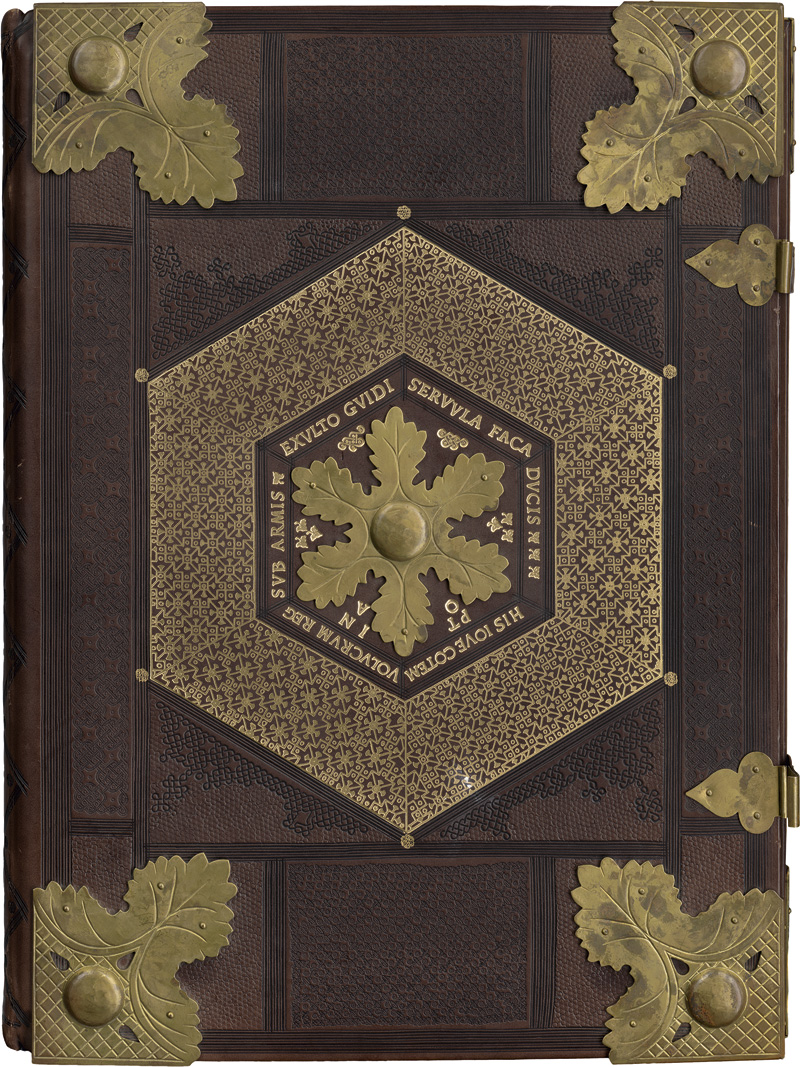
Ptolemaeus, Claudius GEOGRAPHIA UNIVERSALIS, VETUS ET NOVA [EDITED BY SEBASTIAN MÜNSTER]. BASEL: HEINRICH PETRI, MARCH 1540 Folio (316 x 200mm.), 27 maps of the ancient world and 21 of the modern world, together 48 double-page woodcut maps, each within a woodcut border, 7 woodcut diagrams in the text and one full-page woodcut, printer's woodcut device on verso of colophon leaf, small neat library stamp on title, contemporary blind-stamped pigskin over wooden boards with initials CC and dated 1540 on upper cover, title lettered on fore-edge, two clasps, a few small ink stains on map 32, small tear at foot of map 38 (touching image but without loss), tear to map 40 (touching image but without loss), small hole in Cc3 just touching a few letters, small wormhole in last few leaves, a few wormholes in lower board, head of spine torn First edition of Sebastian Münster's Geographia revised from the translation of Willibald Pirckheimer. This was a new and important edition of Ptolemy, with redesigned maps and the text revised by Münster based on the Willibald Pirckheimer Latin translation as corrected in 1535 by Servetus. Sebastian Münster (1448-1552) was a mathematician, geographer and professor at Basel University. He was among the first editors of a published geographical text to quote or acknowledge his sources and authorities. Münster's maps became the most influential general and regional maps until the first appearance of Ortelius's Theatrum orbis terrarum in 1570. The modern world map is Münster's first state, which marks and names the Northwest passage, also naming the northern part of North America, Terra nova seve de Bacalhos, a reference to the Grand Banks cod fisheries, replaced in 1550. Munster based the map of Scandinavia on Jacob Ziegler's map of 1532. The map Novarum insularum is the earliest available separate map depicting the Americas in a recognisable form.
Ptolemaeus, Claudius GEOGRAPHIA UNIVERSALIS, VETUS ET NOVA [EDITED BY SEBASTIAN MÜNSTER]. BASEL: HEINRICH PETRI, MARCH 1540 Folio (316 x 200mm.), 27 maps of the ancient world and 21 of the modern world, together 48 double-page woodcut maps, each within a woodcut border, 7 woodcut diagrams in the text and one full-page woodcut, printer's woodcut device on verso of colophon leaf, small neat library stamp on title, contemporary blind-stamped pigskin over wooden boards with initials CC and dated 1540 on upper cover, title lettered on fore-edge, two clasps, a few small ink stains on map 32, small tear at foot of map 38 (touching image but without loss), tear to map 40 (touching image but without loss), small hole in Cc3 just touching a few letters, small wormhole in last few leaves, a few wormholes in lower board, head of spine torn First edition of Sebastian Münster's Geographia revised from the translation of Willibald Pirckheimer. This was a new and important edition of Ptolemy, with redesigned maps and the text revised by Münster based on the Willibald Pirckheimer Latin translation as corrected in 1535 by Servetus. Sebastian Münster (1448-1552) was a mathematician, geographer and professor at Basel University. He was among the first editors of a published geographical text to quote or acknowledge his sources and authorities. Münster's maps became the most influential general and regional maps until the first appearance of Ortelius's Theatrum orbis terrarum in 1570. The modern world map is Münster's first state, which marks and names the Northwest passage, also naming the northern part of North America, Terra nova seve de Bacalhos, a reference to the Grand Banks cod fisheries, replaced in 1550. Munster based the map of Scandinavia on Jacob Ziegler's map of 1532. The map Novarum insularum is the earliest available separate map depicting the Americas in a recognisable form.
.jpg)


Testen Sie LotSearch und seine Premium-Features 7 Tage - ohne Kosten!
Lassen Sie sich automatisch über neue Objekte in kommenden Auktionen benachrichtigen.
Suchauftrag anlegen